|
Upper Peninsula of Michigan Suggested Fall
Color Tours
Color is usually best the last two weeks
of September and the first week or two of October.
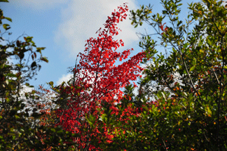
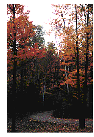
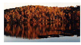
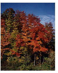
All of the Upper Peninsula is stunning during the fall color
season. Any road winding through the U.P. will show you trees ranging
from a subtle yellow to brilliant red. The flaming maples, oaks and
other hardwoods make a perfect backdrop for the calm waters of the
inland lakes. Fall is our tranquil period when the sounds of the
forest echo around you as humans and wildlife alike prepare for
winter. The peace and quiet of this period are unmatched at any other
time of the year. The leaves are touched with frost, the skies are
the bluest, the evergreens the greenest, and the lakes are the
calmest as they prepare to don their covering of white.
Western Upper Peninsula and the Keweenaw Peninsula
For an outstanding fall tour in the Keweenaw Peninsula, start at Twin Lakes on M-26, 23 miles south
of Houghton. Stop and see beautiful Lake Roland. Then take 41 north
from Houghton through Calumet,
Laurium and Mohawk to Phoenix. Take Highway 26 north from Phoenix
through Eagle River and Eagle
Harbor to Copper Harbor.
Be sure to drive to the top of Brockway Mountain for a fabulous view of Lake Superior and the nearby colorful hills. Return from Copper Harbor on Highway 41 to Delaware, then turn on the
county road to Bete Grise and Lac La Belle. Follow this road to Lake
Linden where you will meet Highway 26. Go south to Hubbell, Dollar
Bay and on to Houghton. Note the steep roofs on the houses. This
allows the snow to slide off the roof rather than cause the roof to
cave in. Approx. 125 miles
|
|
 |
From Baraga, take 41 North to Chassel, then west to
Painesdale. At Painesdale you will see the Champion #4
Shaft-Rockhouse, the oldest mineshaft-rockhouse standing in the
Keweenaw. Built in 1902, this shaft house operated for nearly 65
years until mining operations ceased altogether in 1967. From
Painesdale, take 26 north to the intersection with 38. Go west on 38
to Ontonagon. Take 64 west to
Silver City and the Porcupine
Mountains State Park which contains Michigan's only range of
mountains accessible to the public. Porcupine Mountains State Park is
Michigan's largest (92 square Miles) area of undeveloped wilderness.
Return to Baraga on Highway 38. Approx. 170 miles |
From Crystal Falls, go west on Highway 2 to Ironwood, the heart
of the Big Snow Country. Return on
Highway 28 to Covington, then south on 141 to Crystal Falls. Approx.
220 miles.
Central Upper Peninsula
From Grand Marais, take H 58 west
to Munising (or the reverse).
This trip takes about 2 hours and goes through the Pictured Rocks
National Lakeshore. Stop and see the Pictured Rocks, the Devils
Logslide, the AuSable Lighthouse, and many other scenic places.
Approx 50 miles plus the short miles driven into the scenic sights
and overlooks.
From Grand Marais, go South on 77 to Seney National Wildlife Refuge,
east on 28 to Newberry,
(special
fall color trips in the Newberry area) then north out of Newberry on 123 to Paradise, the gateway to the Whitefish Point Lighthouse, Whitefish Point Bird Observatory and Tahquamenon Falls. 88 miles.
H 58 from Grand Marais east toward Paradise and Whitefish Point is a
rough rural road. |
|
Eastern Upper Peninsula
South of Sault St. Marie, take 48 to DeTour Village, then go
west on 134 and south on 75 to St. Ignace. Approx. 100 miles. When
you come to DeTour, consider going on the ferry accross to Drummond
Island. Drummond Island is a short ten minute car ferry ride from
DeTour Village and has beautiful fall colors, and is a very unique
stop in itself. From DeTour, the ferry runs every hour, forty minutes
after the hour. From Drummond Island, the ferry runs every hour, ten
minutes after the hour. The exceptions are as follows: 3:30 p.m. from
DeTour; 8:00 a.m. from Drummond (for the school children). There is
no ferry crossing at 2:10 a.m., 2:40 a.m., 4:10 a.m. or 4:40 a.m. |
|
One of the best is highway 13 from Nahma Junction to Wetmore
(Lake Michigan to Lake Superior). Approx. 50 miles
If you drive the scenic roads of Marquette County, look for
moose. Moose were airlifted here from Canada in an attempt to
establish a moose herd in the center of the Upper Peninsula. The
effort was successful.
|
|
|
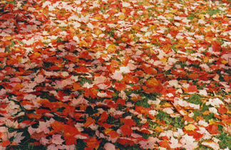
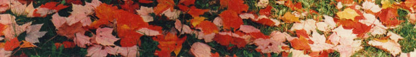
Lot's of fun to play in the leaves.
|
Map of the
Upper Peninsula
Upper Peninsula Towns and Cities Visitor Information
E-Mail
for more information
Site Search
Engine
Back To Recreation Page
Back to Upper Peninsula
Lodging
Back to the Upper Peninsula
Traveler
Back to Exploring the North Home
Page
Copyright 1997 by Vivian Wood, the webmaster for
Exploring the North, Inc. All Rights Reserved. Except as permitted
under the Copyright Act of 1976, as Amended, this web site may not be
reproduced in whole or in part in any manner. Unless authorized by
the webmaster of Exploring the North, Inc., reproduction of any
picyure, web page or pages on the Exploring the North website for
placement on the internet is a copyright infringement. All right,
title and interest in and to the material on our web pages, the web
site, in whole or in part, and in and to this url and the urls
contained within, is the property of vivian wood, the webmaster for
Exploring the North, Inc. Web site created on an Apple G-4. |