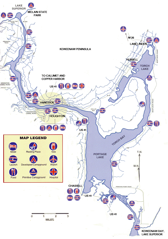
From Keweenaw Bay near Baraga to the North Entry near McLain State Park. There are 4 water trails in the Keweenaw Waterway.
Trail 1: South Entry on Keweenaw Bay to Chassel (8 miles) This is a river segment with a dredged channel. The surrounding land is a mix of wetlands and developed uplands. There are several rivers and streams entering this segment. There is some opportunity to explore small bays and rivers.
Trail 2: Chassel to Houghton/Hancock (11 miles) This is a lake segment. Portage Lake is about two miles wide and four miles long, but only about 40 feet deep. There are no good sheltered spots on this body of water. The waterway arm that extends west to Houghton and Hancock is narrower and has some shelter. One begins to see the remains of the copper mining and smelting industry here.
Trail 3: Houghton/Hancock to Lake Linden (18 miles) through Portage Lake, Torch Bay and Torch Lake. The Torch Bay arm of Portage Lake narrows gradually into a dredged river. Once past the "cuts," the trail enters Torch Lake. This is a deep lake (120') with many remains of the copper smelting industry and some bays worth exploring.
Trail 4: Houghton/Hancock to Lake Superior North Entry (10 miles) The two northern most miles form a formal ship canal; its walls consist of vertical steel revetments which can create reflective waves. Two harbors exist here: Lily Pond, located near the south end of the canal, and a preferred harbor by McLain State Park, inside the Lake Superior breakwall.
About the Water Trail
Welcome to the Keweenaw Water Trail. Along the trail you'll
experience the history, scenic beauty, and fresh water of Lake
Superior. The water trail is a clearly marked, safe, easily traversed
pathway located on the water rather than on land. Water trail sites
are accessible by any small water craft (including kayaks and
canoes). Please note that the map is extremely simplified and should
not be used for navigation. Boaters are advised to obtain the
Keweenaw Waterway Navigational Chart (Chart #14972). You may contact
the Keweenaw Water Trail Association to purchase a more detailed
map.
Recreation in the Chassell MI area
Back to Upper Peninsula Towns and Cities
Back to Upper Peninsula Food and Lodging
Back to the Upper Peninsula Traveler
Back to Exploring the North Home Page
Copyright 2000-06 by the webmaster for Exploring the North. All Rights Reserved. Except as permitted under the Copyright Act of 1976, as Amended, this web site may not be reproduced in whole or in part in any manner. Unless authorized by the webmaster of Exploring the North, Inc., reproduction of any web page or pages on the Exploring the North website for placement on the internet is a copyright infringement. All right, title and interest in and to the material on our web pages, the web site, in whole or in part, and in and to this url and the urls contained within, is the property of vivian wood, the webmaster for Exploring the North, Inc. Website created on an Apple G-4.